Elevate your local knowledge
Sign up for the iNFOnews newsletter today!
Sign up for the iNFOnews newsletter today!
Selecting your primary region ensures you get the stories that matter to you first.

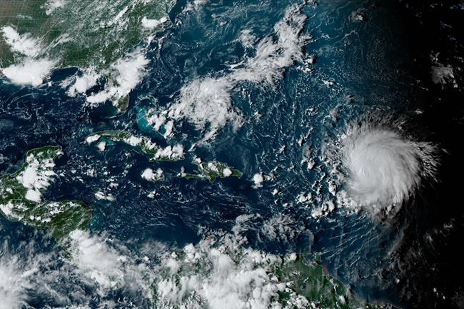
HALIFAX – Atlantic Canadians will learn more about the track of hurricane Lee later this week, after it becomes clear where the powerful storm will begin its journey northwards.
Environment Canada meteorologist Bob Robichaud says the hurricane will be felt in Atlantic Canada by next weekend, but the question remains how close it will come to shore.
He says the point where Lee, currently in the northeastern Caribbean, twists to the north could affect whether it results in higher waves along the East Coast, or severe rain and wind that comes onshore.
Robichaud says that turn is expected by Tuesday or Wednesday.
He says the other key factor will be how far east a high pressure zone over the Great Lakes will move, as this system might help push the hurricane further off the Canadian coast.
Robichaud says another issue will be water temperatures in the storm’s pathway, which could allow Lee to gather momentum or blunt the storm’s impact, if temperatures are low.
This report by The Canadian Press was first published Sept. 9, 2023.
News from © iNFOnews.ca, . All rights reserved.
This material may not be published, broadcast, rewritten or redistributed.

This site is protected by reCAPTCHA and the Google Privacy Policy and Terms of Service apply.
Want to share your thoughts, add context, or connect with others in your community?
You must be logged in to post a comment.