iN PHOTOS: Rising water in the North and South Thompson Rivers

KAMLOOPS – Many boat launches and pathways around the city are closed as crews keep a close eye on water levels in the North and South Thompson Rivers.

Yesterday the B.C. River Forecast Centre issued a flood watch for the waterways and floodwater is rising at city parks near the river.

Gerry Gorman has lived in his River Street property for 28 years and says the water is "higher than normal," and he and his neighbours are monitoring water levels with a "wait and see approach." While basement flooding isn't a concern at his home, Gorman says some nearby houses are facing flooding issues related to groundwater seepage. Over 28 years he's had to place sandbags three times.

To catch up on water levels and spring flood coverage, click here.

How is the flooding situation where you are? Let us know in the comments below or share your photos on our Facebook page.

FILE PHOTO. Boat launch at McArthur Island Park, 2017. Kim Anderson

A rowboat floats beyond the closed pier at McArthur Island Park. | Photographer: Kim Anderson

The Thompson River flooded in 2017 and may do so again this year. Kim Anderson

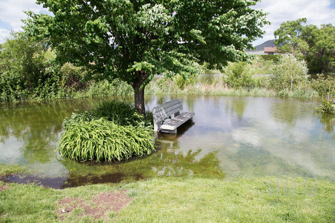
A bench is surrounded by water at McArthur Island Park. | Photographer: Kim Anderson

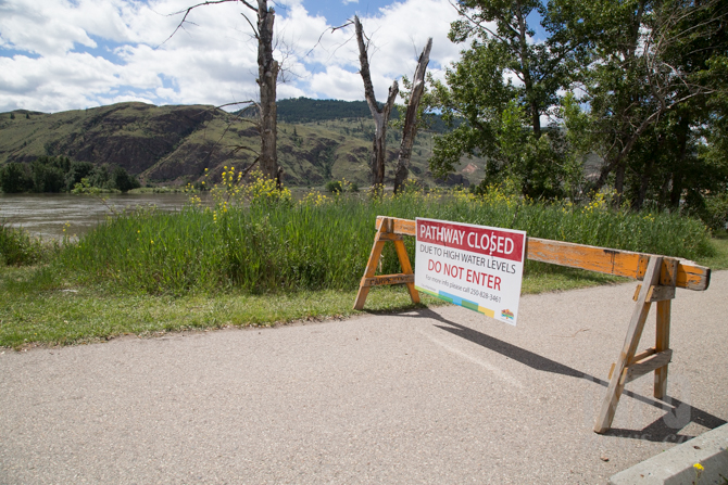
Officials have closed many walkways around the city due to floodwaters. | Photographer: Kim Anderson

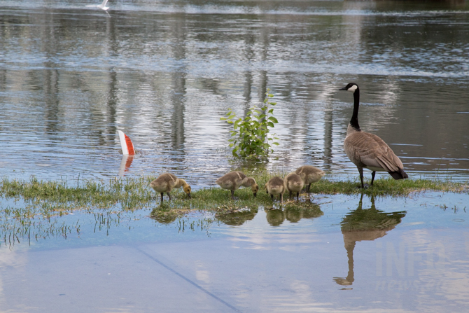
At least the geese and goslings are enjoying the high waters at Riverside Park. | Photographer: Kim Anderson

Crews have taped off areas and walkways at Riverside Park due to high water. | Photographer: Kim Anderson

Water surrounds a bench and walkway at Riverside Park, Friday, June 2, 2017. Kim Anderson

Gerry Gorman has been at his River Street home for 28 years and says water levels in 2012 reached the circular dirt patch on the right hand side of this photo. | Photographer: Kim Anderson

Officials are watching high water on the South Thompson River. | Photographer: Kim Anderson

The dock in front of Storms On the River is catching debris carried by high water. | Photographer: Kim Anderson

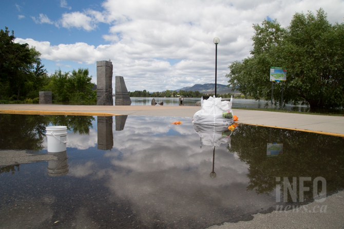
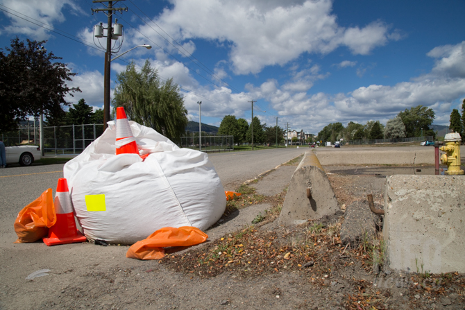
City workers have placed these large bags over storm drains as part of the flood watch procedures. | Photographer: Kim Anderson

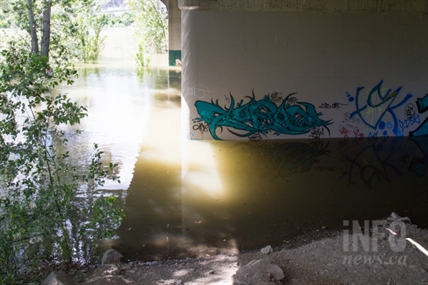
Water under the Overlanders bridge has crept up past the sandbar and trees. Kim Anderson

Kim Anderson


To contact a reporter for this story, email Kim Anderson or email the editor. You can also submit photos, videos or news tips to the newsroom and be entered to win a monthly prize draw.

We welcome your comments and opinions on our stories but play nice. We won't censor or delete comments unless they contain off-topic statements or links, unnecessary vulgarity, false facts, spam or obviously fake profiles. If you have any concerns about what you see in comments, email the editor in the link above. 

Join the Conversation!

Want to share your thoughts, add context, or connect with others in your community? Create a free account to comment on stories, ask questions, and join meaningful discussions on our new site.

Leave a Reply

You must be logged in to post a comment.
Kim Anderson

Originally from a northern B.C. town that boasts a giant fly fishing rod and a population of 3,100, Kim moved to Kamloops in 2011 to attend Thompson Rivers University. Kim is as comfortable behind a camera as she is writing on her laptop. After graduating with a degree in journalism, Kim has been busy with an independent freelance writing project and photography work. Contact Kim at kanderson@infonews.ca with news tips or story ideas.

Kim's Stories