Satellite images show before and after of demolition of White House East Wing
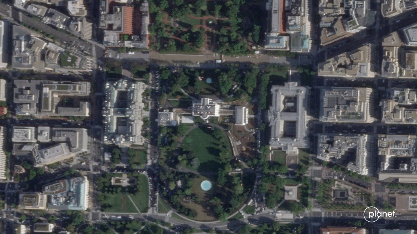
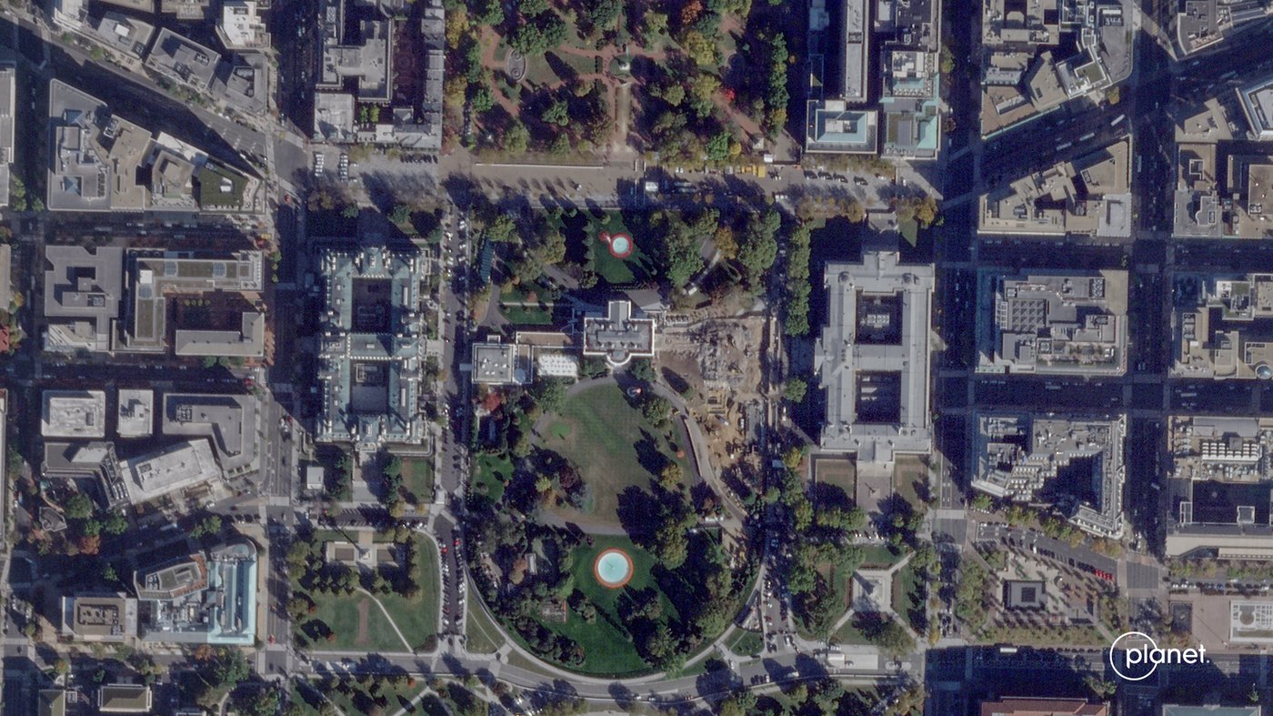
WASHINGTON (AP) — New satellite images taken Thursday show the scale of the demolition of the White House East Wing as President Donald Trump moves forward with the construction of a new ballroom at the White House.

See the change in images from Oct. 23 and Sept. 26, 2025 in images from Planet Labs PBC.
Satellite images show before and after of demolition of White House East Wing | iNFOnews.ca
This satellite image from Planet Labs PBC shows demolition of the East Wing of the White House in Washington, Thursday, Oct. 23, 2025. (Planet Labs PBC via AP)

News from © The Associated Press, . All rights reserved.
This material may not be published, broadcast, rewritten or redistributed.

Join the Conversation!

Want to share your thoughts, add context, or connect with others in your community?

The Associated Press


The Associated Press is an independent global news organization dedicated to factual reporting. Founded in 1846, AP today remains the most trusted source of fast, accurate, unbiased news in all formats and the essential provider of the technology and services vital to the news business. More than half the world’s population sees AP journalism every day.