Elevate your local knowledge
Sign up for the iNFOnews newsletter today!
Sign up for the iNFOnews newsletter today!
Selecting your primary region ensures you get the stories that matter to you first.

THOMPSON-OKANAGAN - We just knew it was too good to be true, Mother Nature is set to remind us winter is not quite over with a couple centimetres of snow by Friday morning and well below normal low temperatures early next week. Environment Canada is forecasting high temperatures to be within the seasonal normals of...
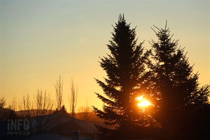
THOMPSON-OKANAGAN - We’ve been experiencing spring-like weather here in the Southern Interior and while that is not set to change we may see another blitz of snow before Saturday. Environment Canada is still calling for above seasonal normal temperatures during the day but with overnight lows close to seasonal normals of -3 Celsius and a...


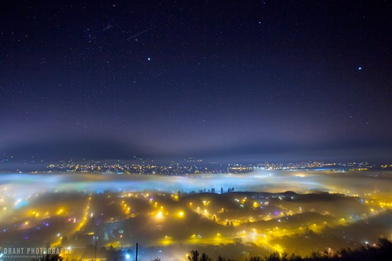
EVEN THE METEOROLOGISTS AREN'T TOO SURE KELOWNA - It may not seem like a real valley inversion — the kind locals dread which leaves a thick layer of cloud hovering just overhead, lasting sometimes for weeks — but the inversion and the rolling fog clouds it is causing are very real, enough to cause flight...

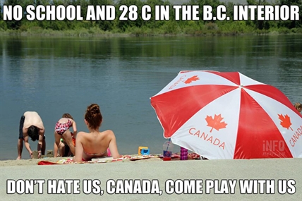
KAMLOOPS – The spring-like weather continues for Penticton with a record high temperature on Sunday, Feb. 8. The mercury rose to 13 C, breaking the old record of 11.1 C on the same day in 1945, according to Environment Canada’s website. To put things into perspective, the normal high for his time of year is...
THOMPSON-OKANAGAN – If it felt like spring on Friday it might have been the record breaking spring-like high temperatures. Four communities in the Thompson-Okanagan broke high temperature records on Feb. 6. The high temperature recorded at the Kelowna Airport was 11.7 C, snapping the old record of 7.6 C in 1978, according to Environment Canada....
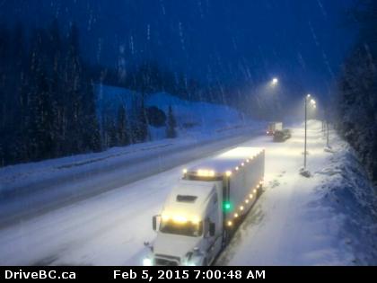
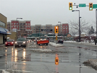
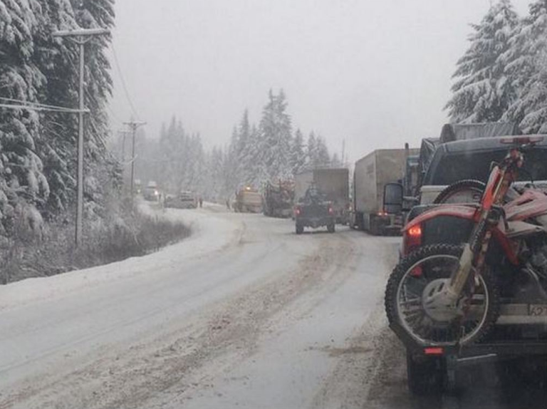
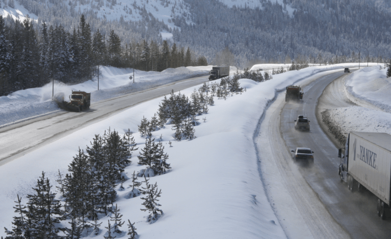
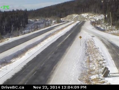
THOMPSON-OKANAGAN - A winter storm is bringing heavy snow to much of the province today and tonight and the Southern Interior is no exception. Environment Canada says to expect heavy snow on Highway 1 from Eagle Pass to Rogers Pass—up to 25 centimetres by Friday morning—and on Highway 3 from Paulson Summit to Kootenay Pass....
THOMPSON-OKANAGAN - More snow is in the forecast for the North Okanagan, Shuswap and North Thompson areas. Environment Canada issued a snowfall warning for the North Okanagan and Shuswap regions at 1:54 p.m. Thursday, Jan. 15, 2015, calling for approximately 10 cm of snow. By 7:30 p.m. the warning was extended to include the North...
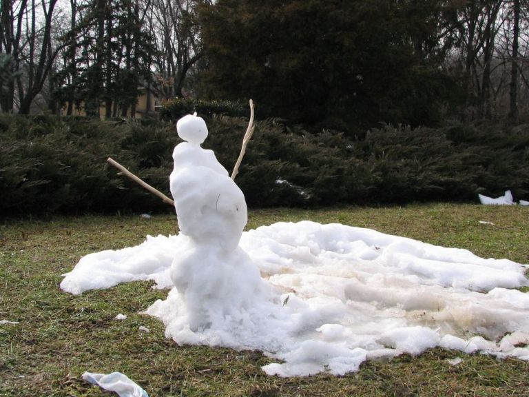
THOMPSON-OKANAGAN - After a dump of nearly 40 centimetres of snow in many parts of the Southern Interior we are now looking at temperatures above seasonal normals all week. According to Environment Canada we can expect to see highs of about 2 Celsius Monday and Tuesday and of 0 C Wednesday and Thursday. By the...
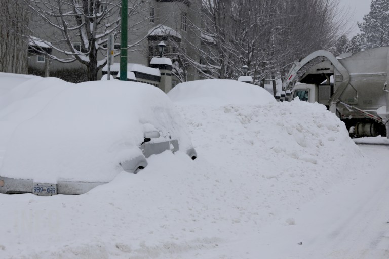
ONLY KELOWNA COMES CLOSE THOMPSON-OKANAGAN - Nearly enough snow fell on Kelowna to set new two-day snowfall records this week but it was nowhere near the amount that fell on Penticton in 1932. The storm began late Saturday evening and had ended in much of the region by Monday evening. After two days of solid...
THOMPSON-OKANAGAN – It’s been a long time since the Thompson-Okanagan received such a massive dump of snow in such a short time. “It has been quite an amazing snowfall so far,” Environment Canada meteorologist Lisa Coldwells says. By 10 a.m. Monday, we were looking at amounts which ranged from 25 centimetres in the South Okanagan,...
THOMPSON-OKANAGAN – Emergency crews were kept hopping Sunday as mother nature hit the Southern Interior with a major dump of the snow, the first huge dump of the winter. A severe winter storm warning was issued by Environment Canada Saturday predicting 10 centimetres of snow in the valley bottoms and up to 40 cm on...
THOMPSON-OKANAGAN – A warning from Environment Canada about a strong winter storm advancing from the B.C. coast and arriving in the Southern Interior Sunday morning has been updated and confirms more snow will fall than originally expected. A clash of warm, moist Pacific air with the already entrenched arctic air will lead to significant snowfall...
BUT WILL BE BACK SOONER THAN YOU THINK THOMPSON-OKANAGAN - Winter is officially here. Much of the region is covered in snow and Mother Nature decided to plunge us into a deep cold once again. With that in mind we decided to take a look back at just how hot our summer weather was in...
VERNON - It’s beginning to look a lot like Fog-ville. The Vernon and Armstrong areas have been socked in with low-lying fog on and off for days, leaving the region cloaked in the wrong kind of white stuff for the holidays. So what’s causing the stubborn fog, and when will it be on its merry...

YOUR PHOTOS FROM AROUND THE NORTH OKANAGAN VERNON - North Okanagan residents woke up to a thick blanket of snow Wednesday morning. Environment Canada is calling for 2-4 cm of snow today, though the white stuff is expected to change to rain sometime this morning. The dump of snow means buses in the Vernon school...
THOMPSON-OKANAGAN - Mother Nature seems determined to let us know we are well on our way to winter with yet another round of heavy snow expected to hit area highways today. The system currently over the Interior will continue to drop heavy snow on mountain passes through tonight though the snow will start to mix...
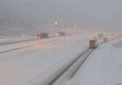
TRANS CANADA CLOSED NEAR REVELSTOKE THOMPSON-OKANAGAN – A break from the snowfall on the upper level highways in the Thompson-Okanagan region Saturday after a dump overnight, but not for long. The meteorologists at Environment Canada are predicting another bout of heavy snow in the mountain passes Saturday night and into Sunday. A special weather statement...

THOMPSON-OKANAGAN – Winter is coming our way with a vengence as cold Arctic air rushes into the Southern Interior on Monday. Environment Canada has issued a Special Weather Statement warning temperatures throughout the Okanagan and South Thompson will be five to ten degrees below seasonal normals. Forecasters say by Tuesday, daytime highs will be below...

THOMPSON-OKANAGAN - Cover your fragile plants and get your ice scrapers ready, fall is officially here and with that comes a risk of frost. With highs of 13-15 Celsius Thursday and temperatures expected to dip as low as 2 C overnight at airports throughout the region Environment Canada is calling for a risk of frost...
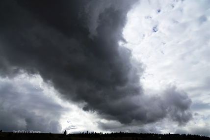
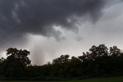
THOMPSON-OKANAGAN - A severe thunderstorm watch issued this morning has been lifted for Kamloops, Vernon and the Shuswap. Environment Canada issued the watch for nine different regions, include the North and South Thompson, the North Okanagan and the Shuswap, this morning. The watch extended north through the Cariboo and east to the Alberta border in...
THOMPSON-OKANAGAN - The severe thunderstorm watch for today ended at 6:54 p.m. for all regions except Penticton, which saw the watch lifted just before 9 p.m. Today marked the fifth day in the past 10 days a severe thunderstorm was issued for the region. Environment Canada issued the severe thunderstorm watch Thursday morning for the...
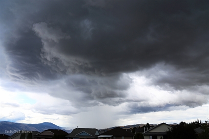
UPDATE: A severe thunderstorm watch for the Okanagan, South Thompson and Nicola areas has been lifted. Environment Canada states the conditions required to produce severe weather no longer apply. THOMPSON-OKANAGAN - Torrential rains, strong winds and hail are all possible as an unstable airmass moves over the region. Environment Canada has again issued a severe...
THOMPSON-OKANAGAN - UPDATE: 8:49 p.m., Aug. 14 The severe thunderstorm watch for the South and North Thompson and Nicola regions has ended. Short-lived storms passed through the region late afternoon and early evening, but no major damage has been reported. UPDATE: 6:07 p.m., Aug. 14 The severe thunderstorm warning has been downgraded back down to...
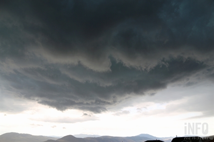
THOMPSON-OKANAGAN - For the second day in a row the risk of severe thunderstorms in the Interior passed before any damage could be done. Much of the region received at least some rain overnight or this morning. While it stopped by mid-morning, a 30-40 per cent chance of showers remains tonight. Environment Canada issued the...