
map
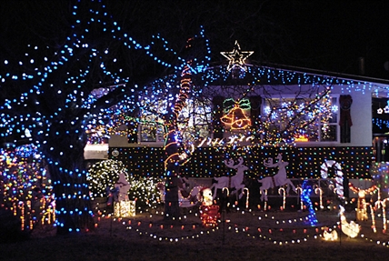
MAP: Christmas lights in Kelowna
KELOWNA - From Candy Cane Lane in Springvalley to Rotary's Kerry Park display, residents of Kelowna have stepped up their efforts this year to make it one of the best ever for lovers of light. Although we were unable to get all the light displays in the city on this map, it does represent all...
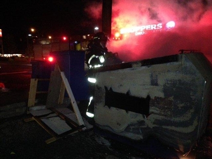
A closer look at Vernon’s rash of arsons
TIMES AND LOCATIONS DISPLAYED ON ARSON MAP VERNON - While investigators continue to hunt for clues in a continuing series of suspected arsons, a map shows most were set within four kilometers of each other between 11 p.m. and 5 a.m. The suspicious fires — set in dumpster bins, pallets, vacant homes and vehicles —...